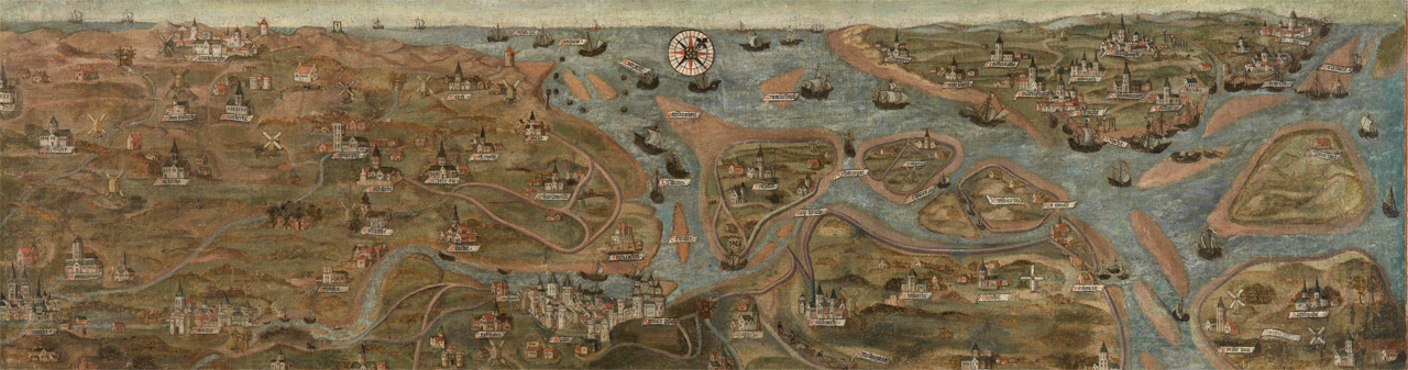
Between 2019 and 2024, an interdisciplinary team at Ghent University studies the role of Bruges as a late-medieval harbour and the maritime-cultural landscape stretching along the Zwin tidal inlet, as depicted on the above map by Jan de Hervy (1501, Groeningemuseum). On this map, the area between Bruges and the sea is not depicted ’empty’, but is dotted with several outports, of which Damme and Sluis are best known. Other outports, such as Hoeke and Monnikerede, have disappeared after the economic downfall of the city and have since been preserved under a thin layer of polder clay. A unique combination of archaeological, historical, and paleo-ecological/geological research into this complete maritime-cultural landscape allows a renewed insight of the dynamic interaction between man and nature, the connectedness to the local and global trade network, the transactions in bulk goods and the impact of the many foreigners residing in the area on material culture.